New Orleans is a lovely old city and I love looking at old houses. The suburb of New Orleans East is not particularly old and not particularly attractive. I bicycled out there anyway.
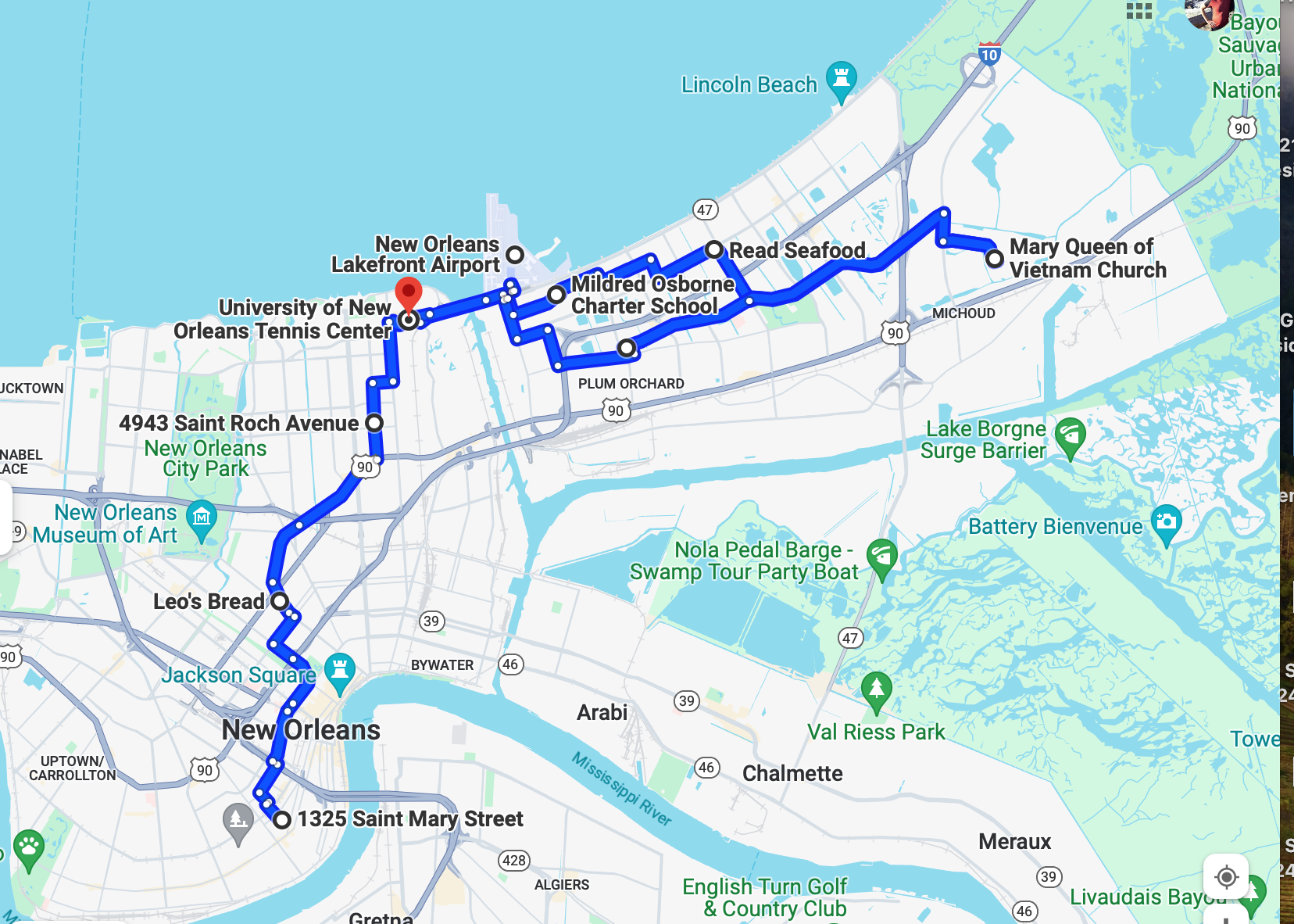
This is the daylong forty mile bike ride I ultimately took.
New Orleans East is a suburban area developed in the 1960’s and 70’s after I-10 was completed. Miles of suburban housing and a large shopping mall followed. My observation is that when the population of an American neighborhood becomes more than fifty or sixty percent Black, the Whites begin to move out. This happened in New Orleans East in the 1990’s. After Katrina hit New Orleans East in 2005 the population became almost entirely Black, except for the Vietnamese community at the eastern end. I have cycled all over America and I cannot think of many other sprawling suburban areas of an American city that are almost entirely Black. Commercial areas of New Orleans East that had been struggling before the storm were never rebuilt. Zeroing in on the map above, New Orleans East is usually defined as the area to the east of the north/south Industrial Canal in the center.
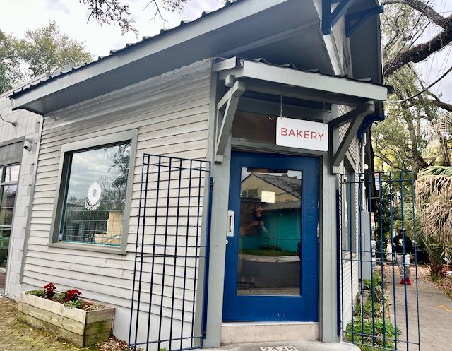
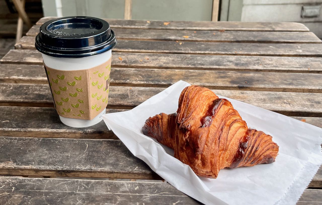
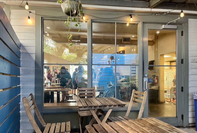
It is ten miles from my Lower Garden District home to the Leon C Simon bridge across that canal. Five miles in I stopped for breakfast. I have discovered Leo’s Bread, near Esplanade and Broad Street in Mid-City. It might have the best truly fresh and quality bread in all of New Orleans. The croissants this morning were less than two hours old, crisp with butter and large enough that one could satisfy two people. They have a few outdoor tables on their patio. Yum.
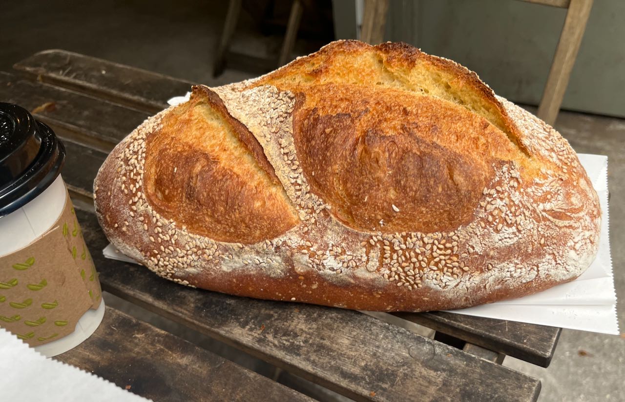
I could not leave without a loaf of their delicious semolina and sesame bread, hipsterly priced at $ 8.75 with a request for tip, 18%, 20%, or 25%. With the tip and tax it costs over ten dollars and I would have to haul it all day on the back of the bike in a paper sack. It was still worth the effort. At home we slice it before freezing in a plastic bag. One loaf lasts a week as Tootie and I toast a piece each night with dinner..
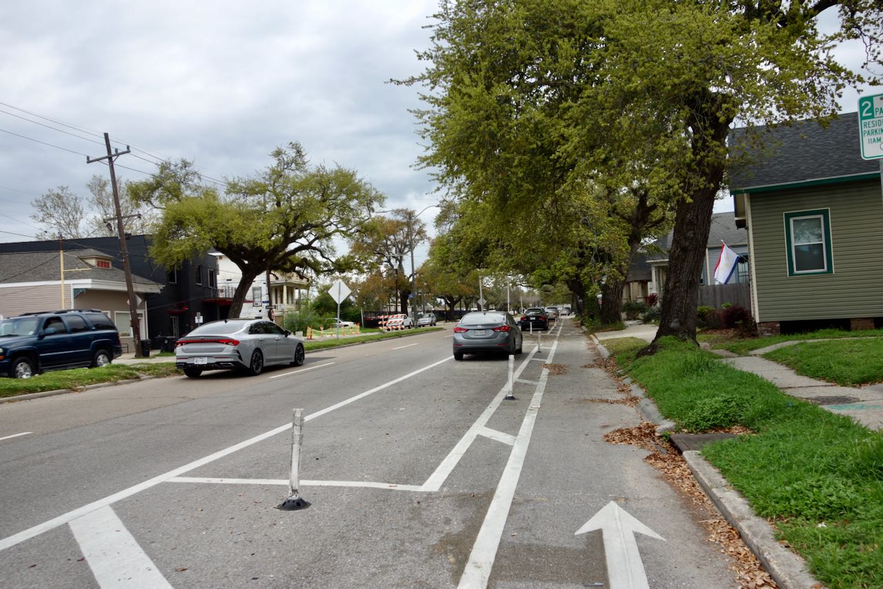
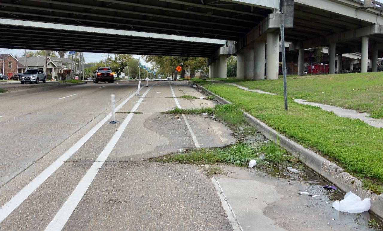
Time to keep cycling! I Headed out Gentilly Boulevard on the almost useless bike lane. It would have been better just to have a wide travel lane. When passing under I-610 the bike lane was covered in grass and debris.
Prefacing the situation I was to see in New Orleans East, at the big intersection of Gentilly Boulevard and Esplanade Avenue, in now what is a mostly Black neighborhood there are several 1950’s strip shopping centers but no longer a mainstream grocery store. I had read that the neighborhood is upset over the situation. There are a lot of takeout restaurants and a Walgreens drugstore. Walmart is a mile away.
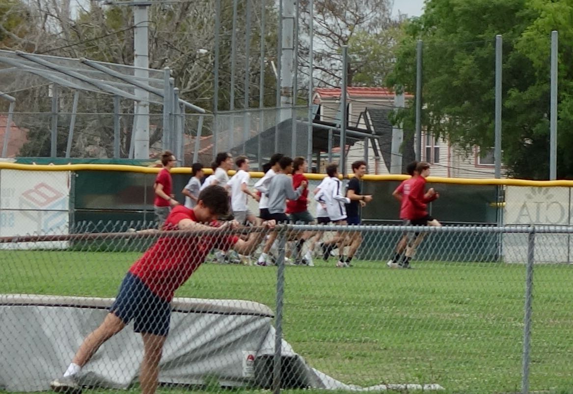
A little further on I passed the mostly White Catholic school Brother Martin and its athletic fields. They seemed to be practicing for Spring Football.
New Orleans has tidbits of lovely urbanity in so many places, Turning left towards Lake Ponchartrain I cycled down St. Roch Avenue under its live oaks. The street was undergoing repair,

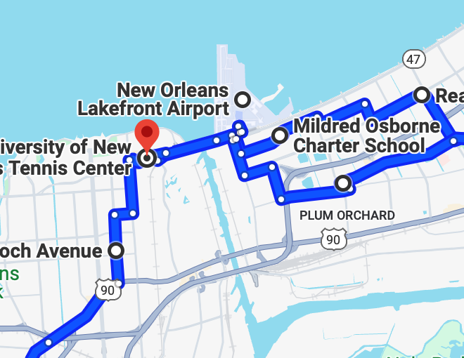
The bridge on Leon C. Simon Boulevard is not ideal but still the safest way to bicycle across the Industrial Canal into New Orleans East. The approach might appear dangerous but had little traffic on a this weekday morning.
Someone has blocked off the right lane of the bridge, making the bicycle crossing almost feel safe. Of course I did not “walk the bike”. Where would one even walk? It makes no sense.

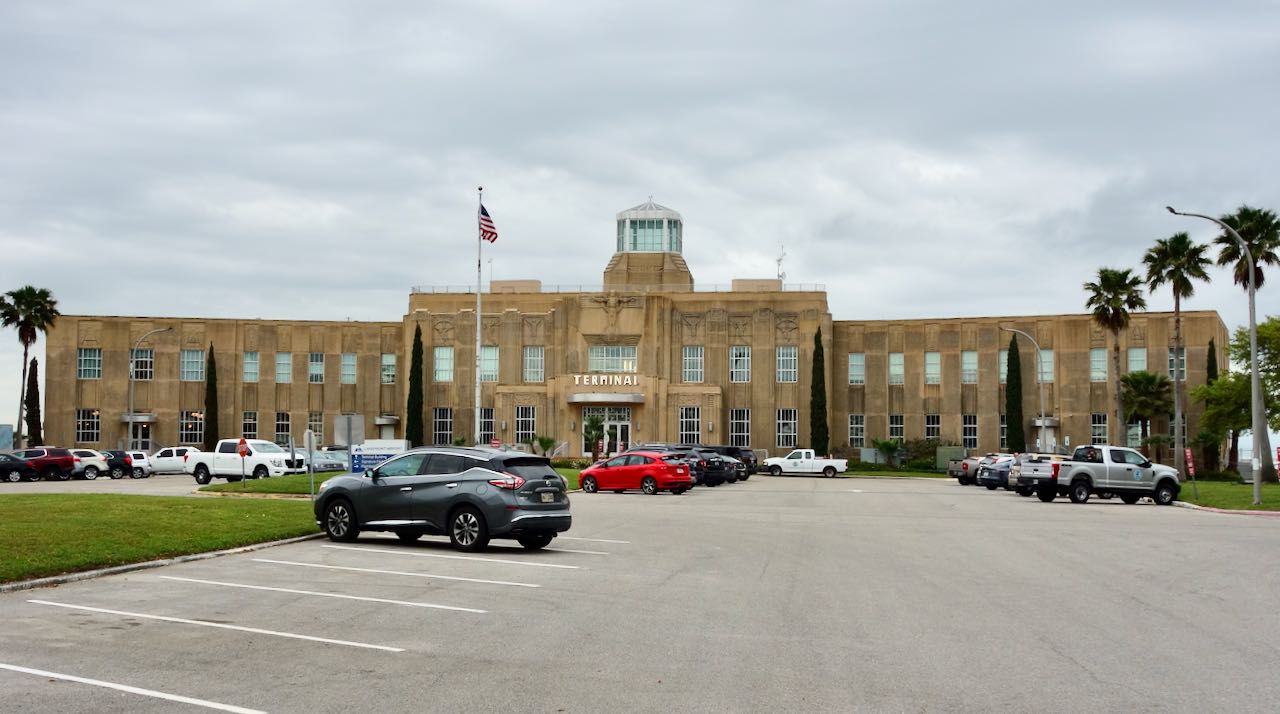
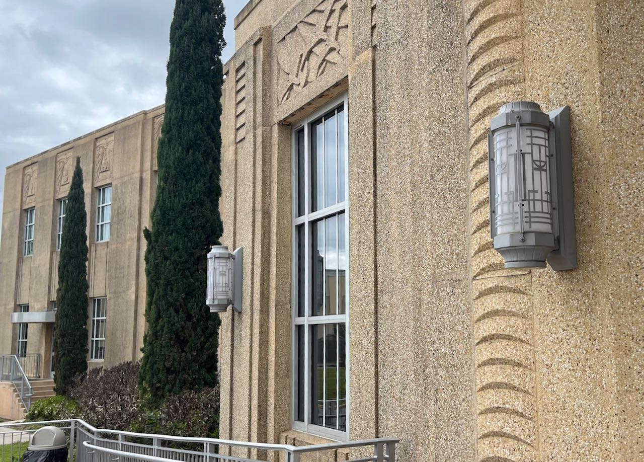
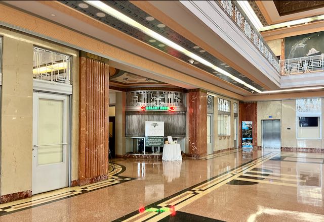
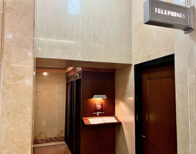
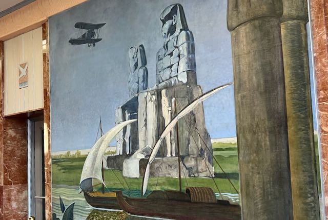
I hung close to the right shoulder as I cycled over the bridge, From the top one can see the sprawl of shipyards and heavy industry that lines the Industrial Canal. At the bottom of the bridge, on the left, is Lakefront Airport, Opened in 1934 to much aplomb, it was built on dredged land extending out into Lake Ponchartrain. Its runways were too short and in 1946 it was supplanted by the larger Moisant Airport (now Louis Armstrong International Airport) nineteen miles to the west. At the foot of the bridge I cycled to Lakefront Airport and its fully restored terminal building. The airport continues to service private general aviation. The terminal building hosts a restaurant, and the entire building is sometimes rented out for wedding receptions. It all is very art-deco.

I cycled briefly on Downman Road to get under the railroad tracks, then took a left on Wales Street through suburban neighborhoods.
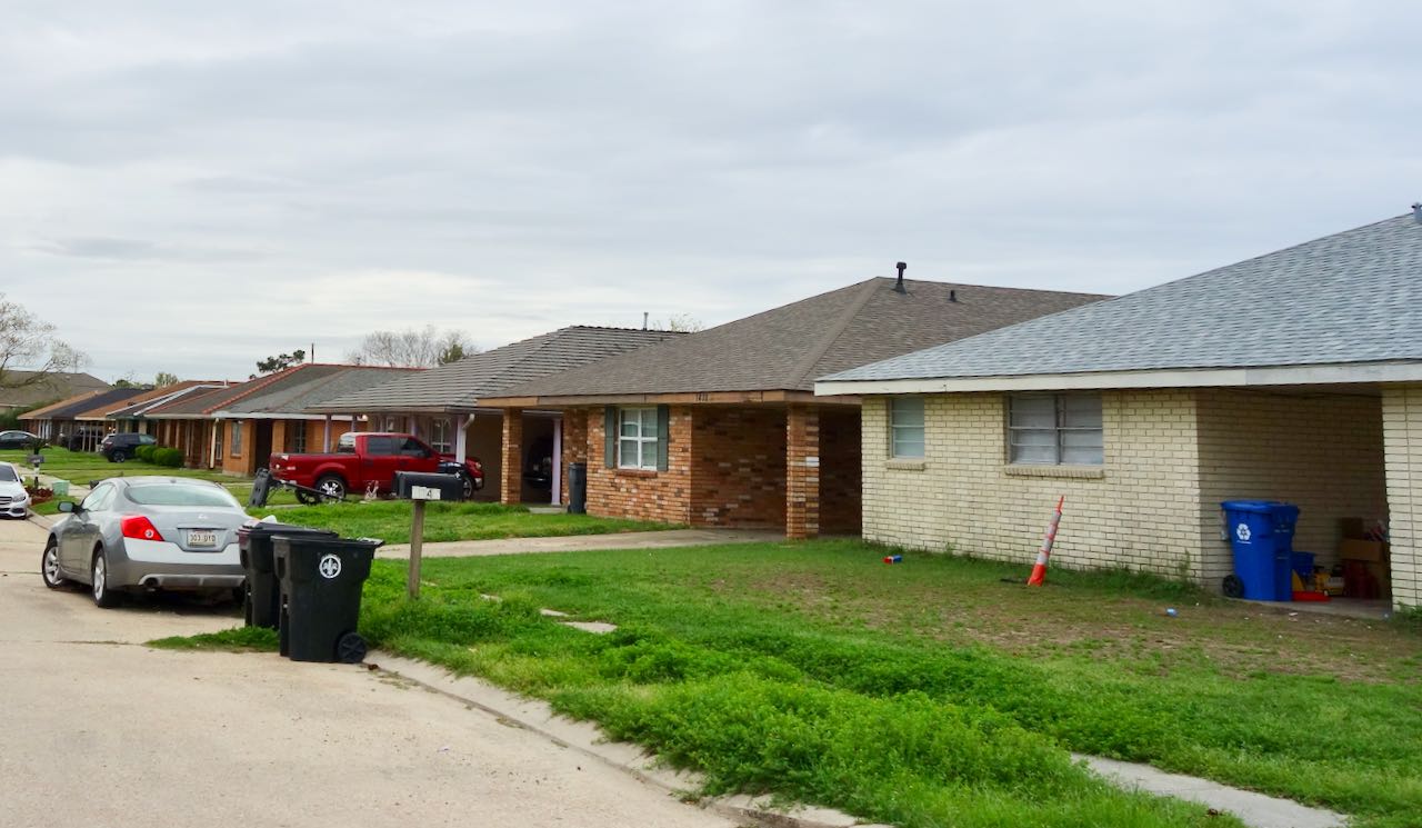
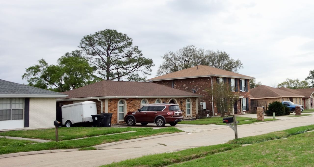
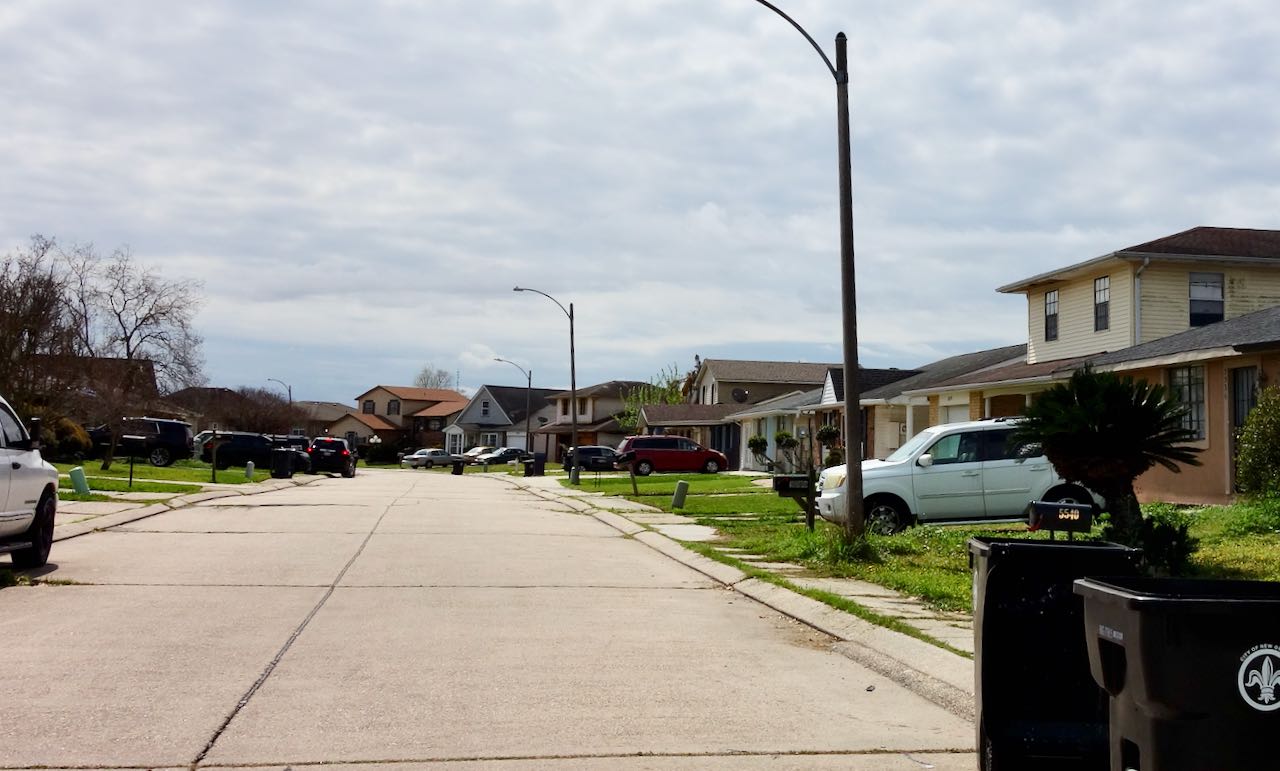
South Louisiana has a distinctive 1960’s architectural style, hip roofed brick mostly one story single family houses that sits on concrete slabs. Identical seeming houses stretch on through New Orleans East for miles. Even though this is suburbia, by national standards these Louisiana style houses are very close together on small lots.

Restaurants! I had brought my own lunch (peanut butter and strawberry jam on whole wheat bread) but I wanted to check out my hypothesis, which was that New Orleans East has almost no sit-down restaurants. My other hypothesis is that the Black community prefers take-out. I stopped briefly by Read Seafood, named after the street Read Boulevard.
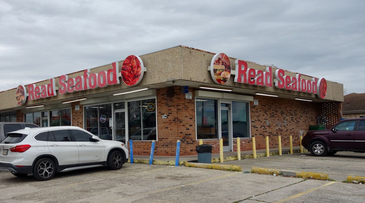
The menu looked delicious, mostly different types of fried seafood but also po-boy sandwiches. The woman at the counter looked Asian. There was no seating.
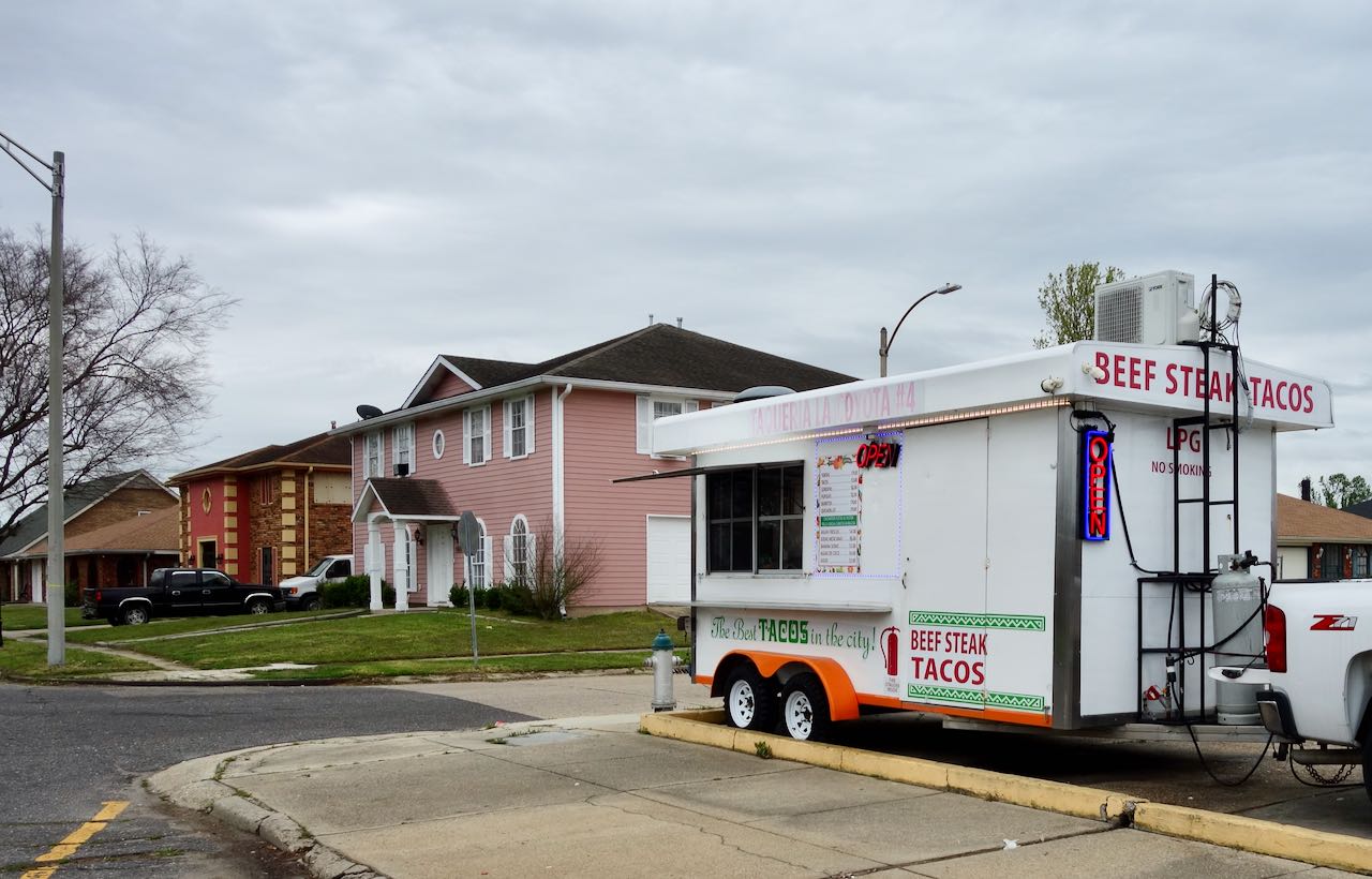
In the parking lot was a taco truck, also with no seating.
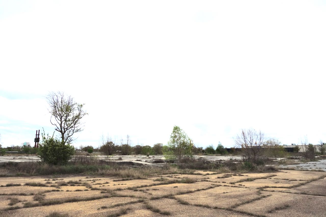
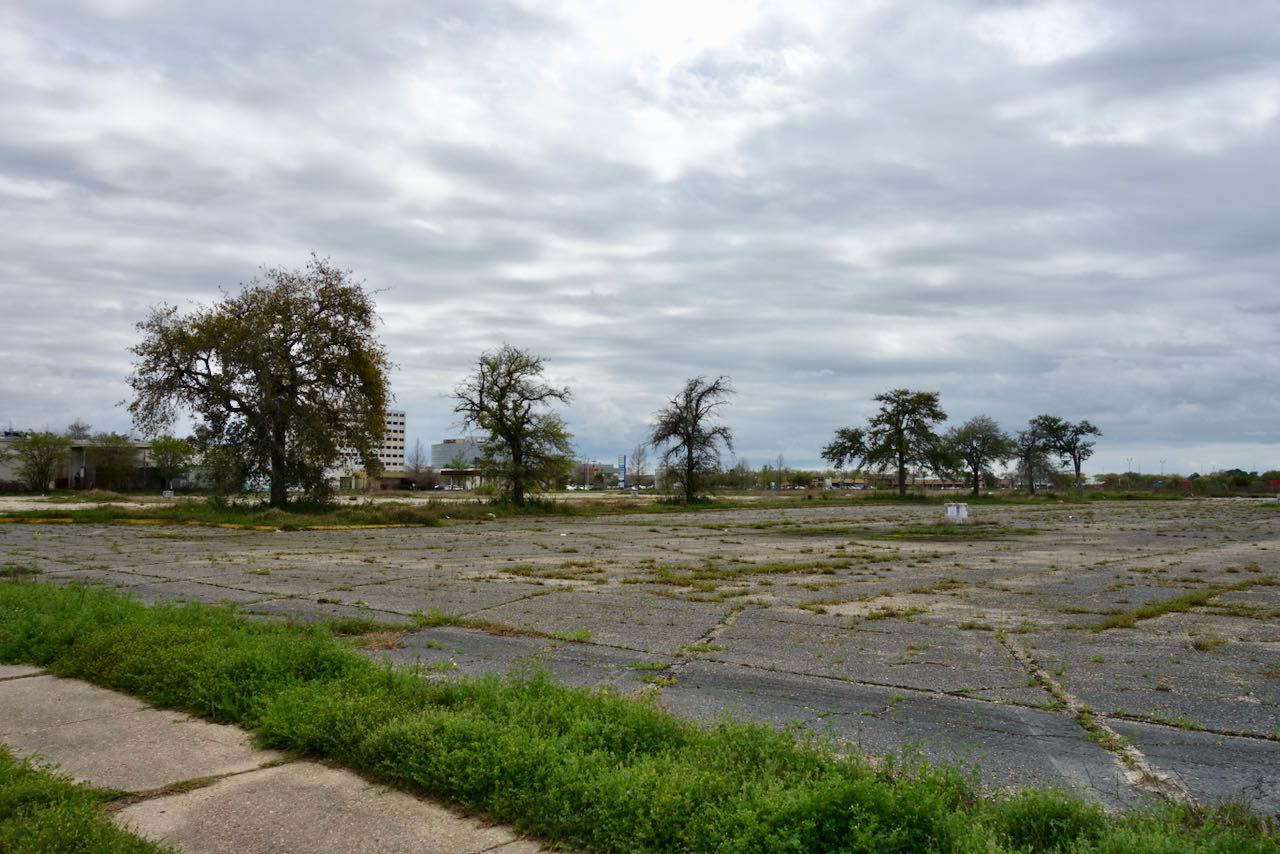
Lake Forest Plaza was one of the largest regional malls when it opened in 1974 with a base of three large department stores. Wikipedia states that in the late seventies it produced 25% of all sales tax revenue in the city of New Orleans. Wikipedia points to “changing demographics” to explain why the mall had essentially closed even before it was flooded by Hurricane Katrina in 2005. The remains were demolished in 2007. Most of that huge plot of land remains a vacant flat piece of concrete.
After the Katrina in 2005 there was a large Lowes Home Improvement store built on one corner of the site of the former mall. That also has closed. The cars in the lot were there for some kind of construction project.

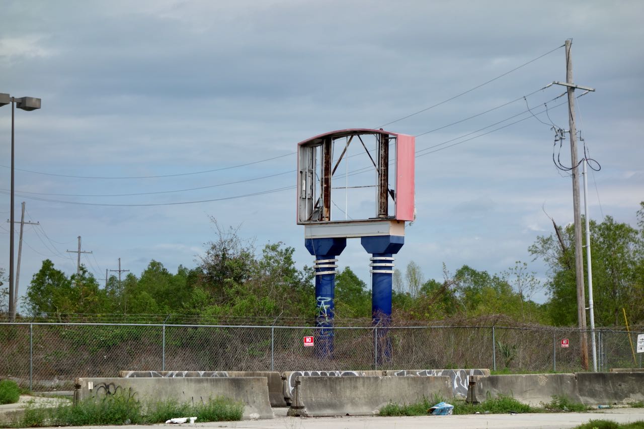
The abandoned remains of a bank drive-in sat in one corner.
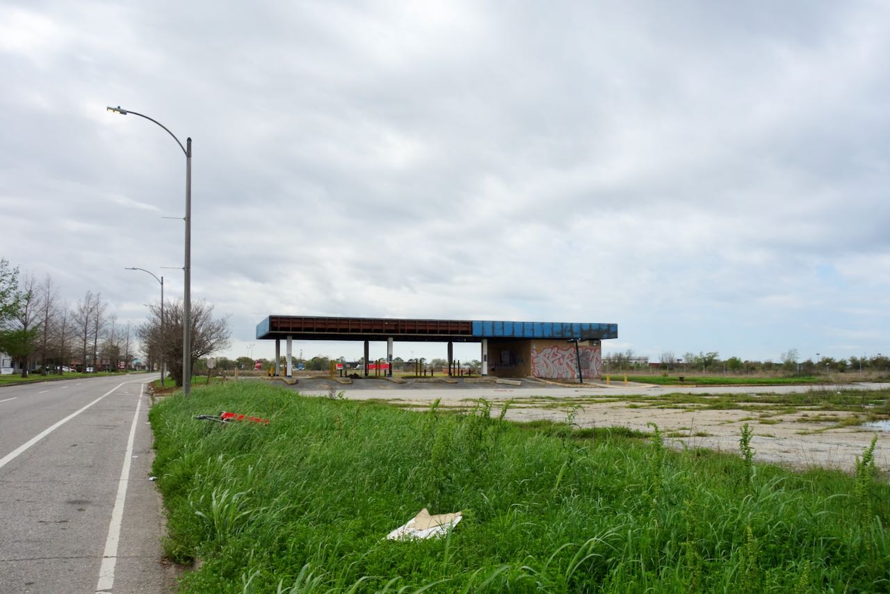
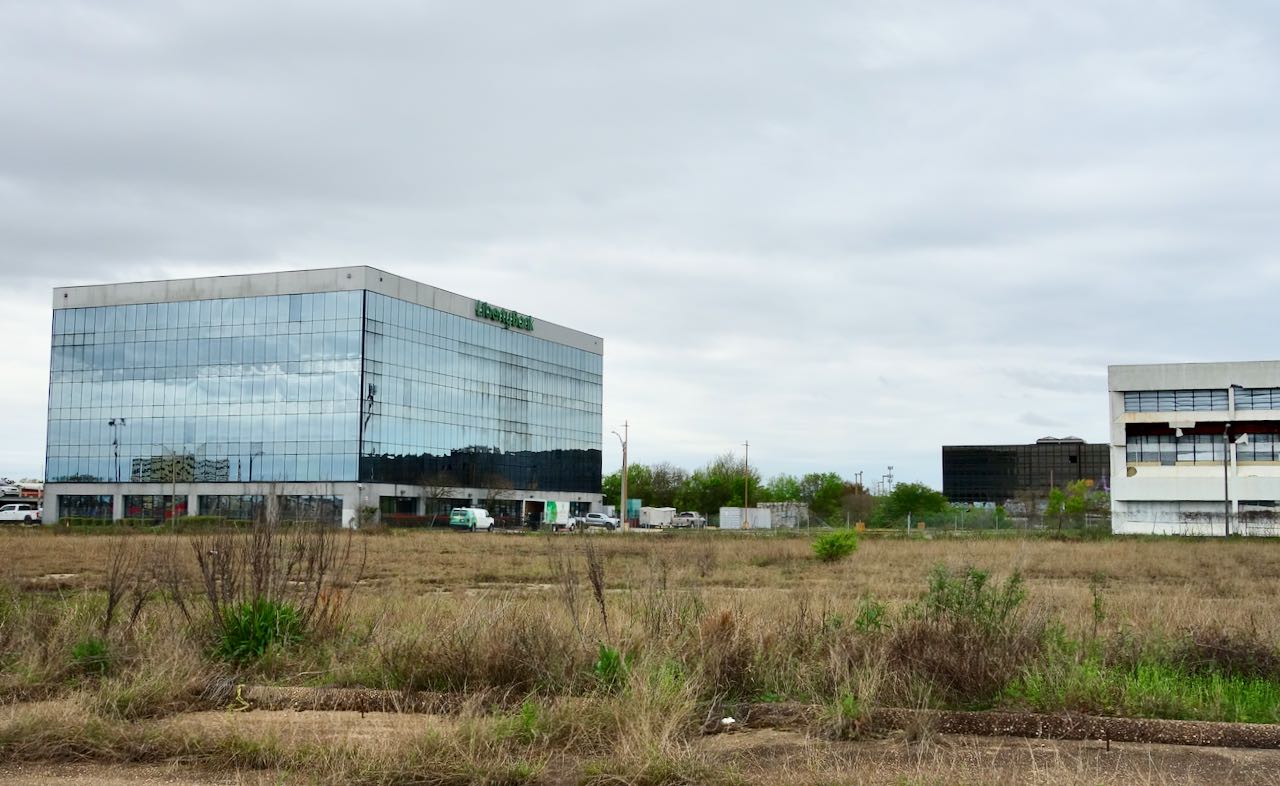
The best known Black-owned bank in New Orleans is Liberty Bank. Liberty’s current headquarters is a pristine modern building that sits adjacent to an abandoned office complex. Both are surrounded by empty overgrown parking lots adjacent to the the site of the former mall,
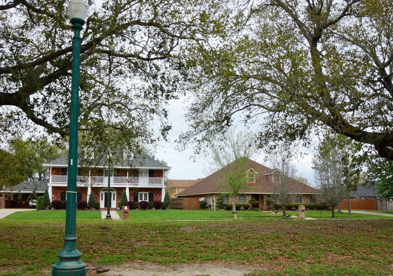
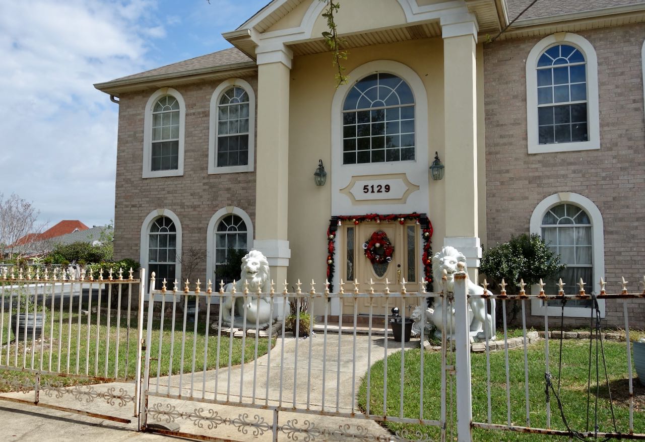
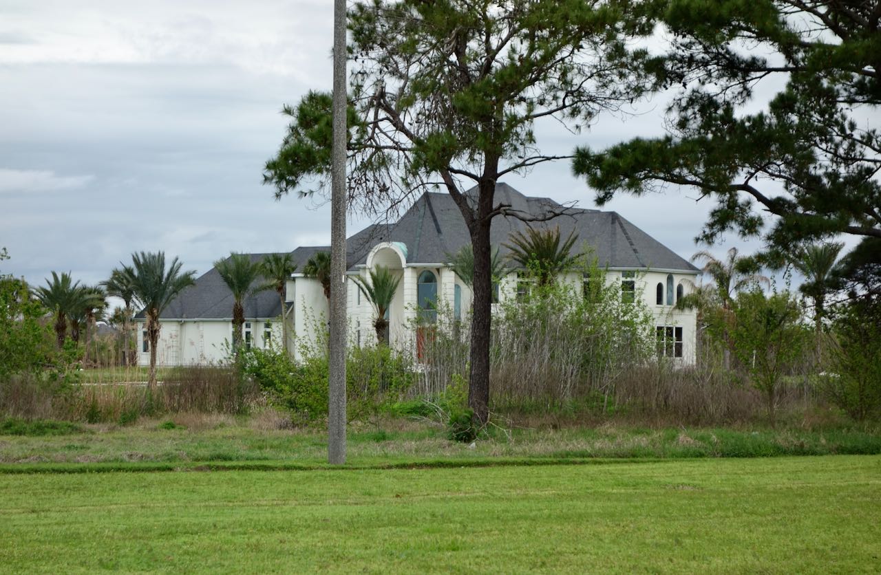
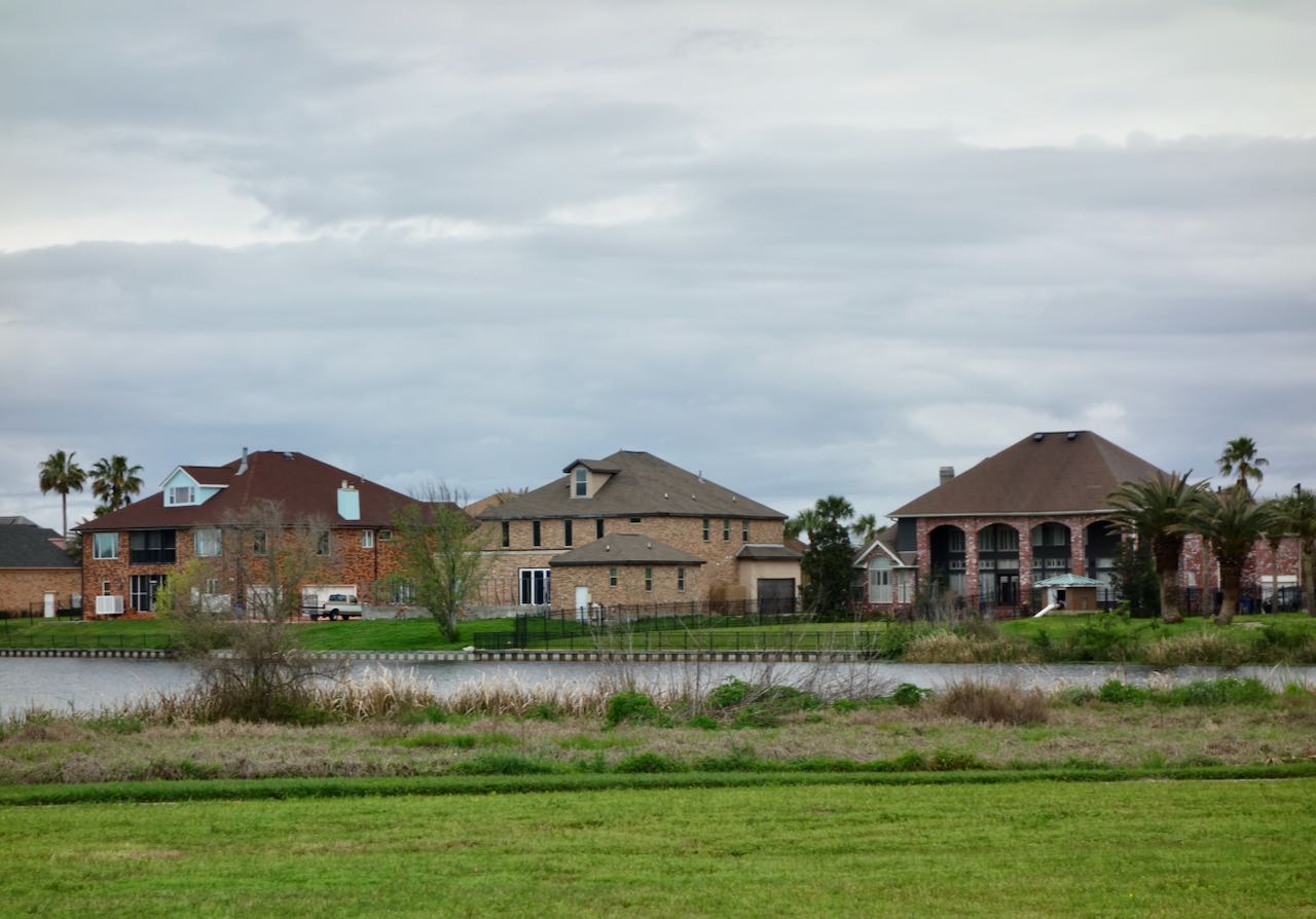
I continued cycling eastward, now on the surprisingly bicycle-friendly Lake Forest Boulevard. The largest and apparently most valuable homes in New Orleans East seem furthest east, including neighborhoods like the one below.
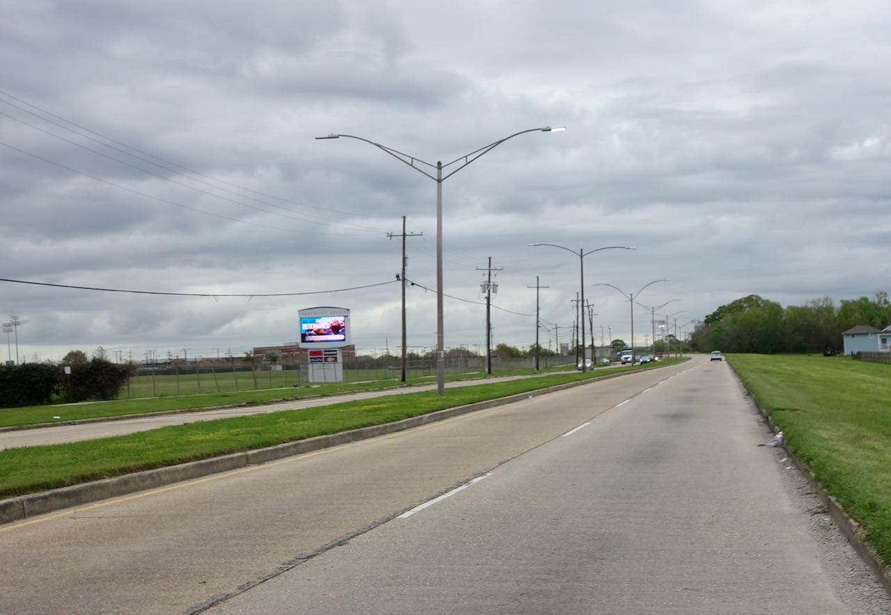
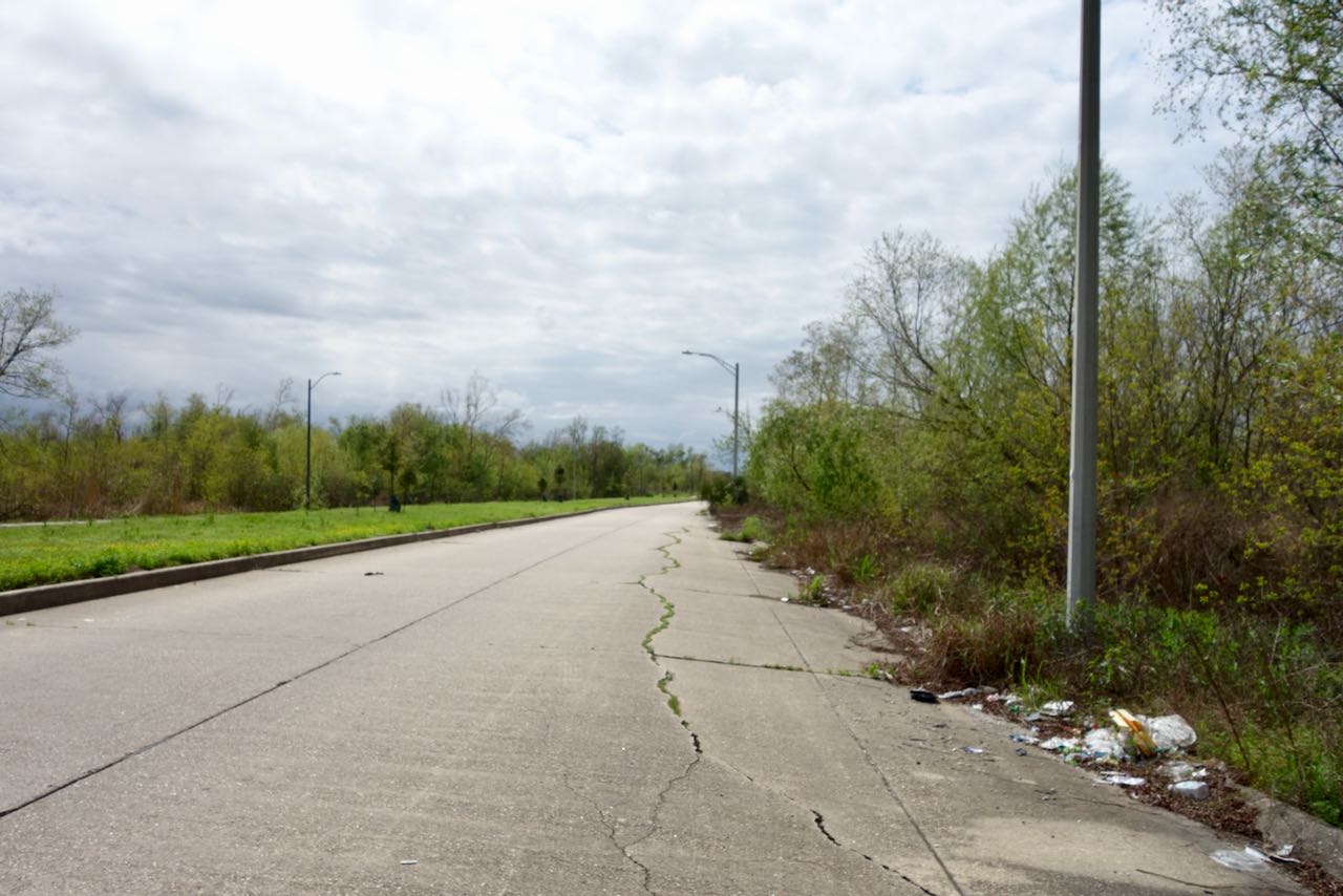
As Lake Forest Boulevard passes under I-510 most of the development ends. With a few exceptions it is mostly swamps out here. The lightly used highway is strewn with trash.
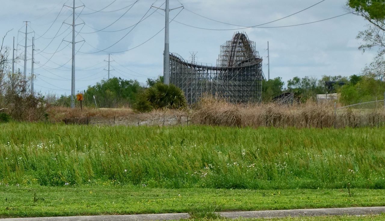
It all seemed like a good idea at the time, to open a huge theme park out here. First as Jazzland in the year 2000, then changing its name to Six Flags New Orleans in 2003, the park was heavily flooded during Hurricane Katrina in 2005 and was never fixed or reopened. There have been multiple plans to clear this site but the ruins of a roller coaster are still visible from Lake Forest Boulevard. I could have trespassed but I am too old now to brazenly break the law.
I cycled by the former entrance.
There is only one appreciable housing development beyond I-510, the tract originally called Village De L’Est. In the latter part of the twentieth century it became the center of the Vietnamese community of New Orleans. I bicycled through its suburban streets.
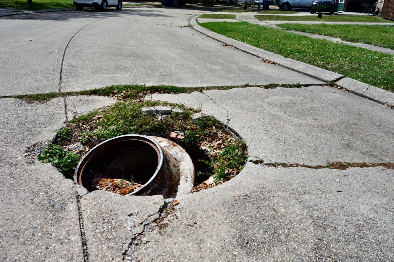
To those of us who live in New Orleans, huge and dangerous holes in the streets are not unusual. This one in Village De L’est seems particularly impressive. There were no danger markings whatsoever.
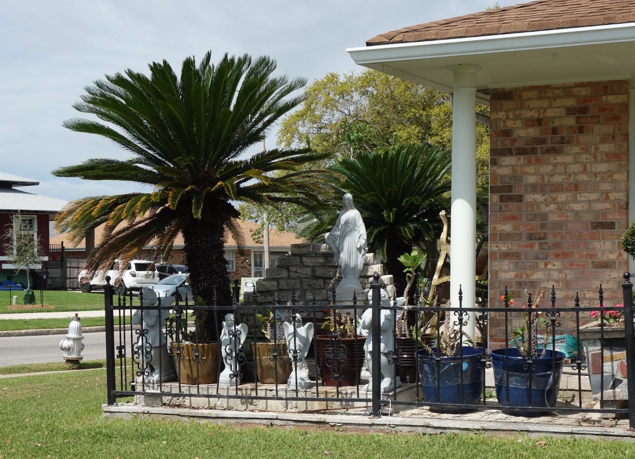
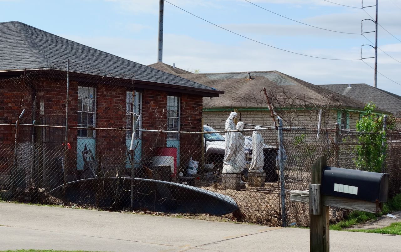
The occasional house displayed signs of immigrant exuberism.
This neighborhood appears to becoming less Vietnamese. Fences are going up.
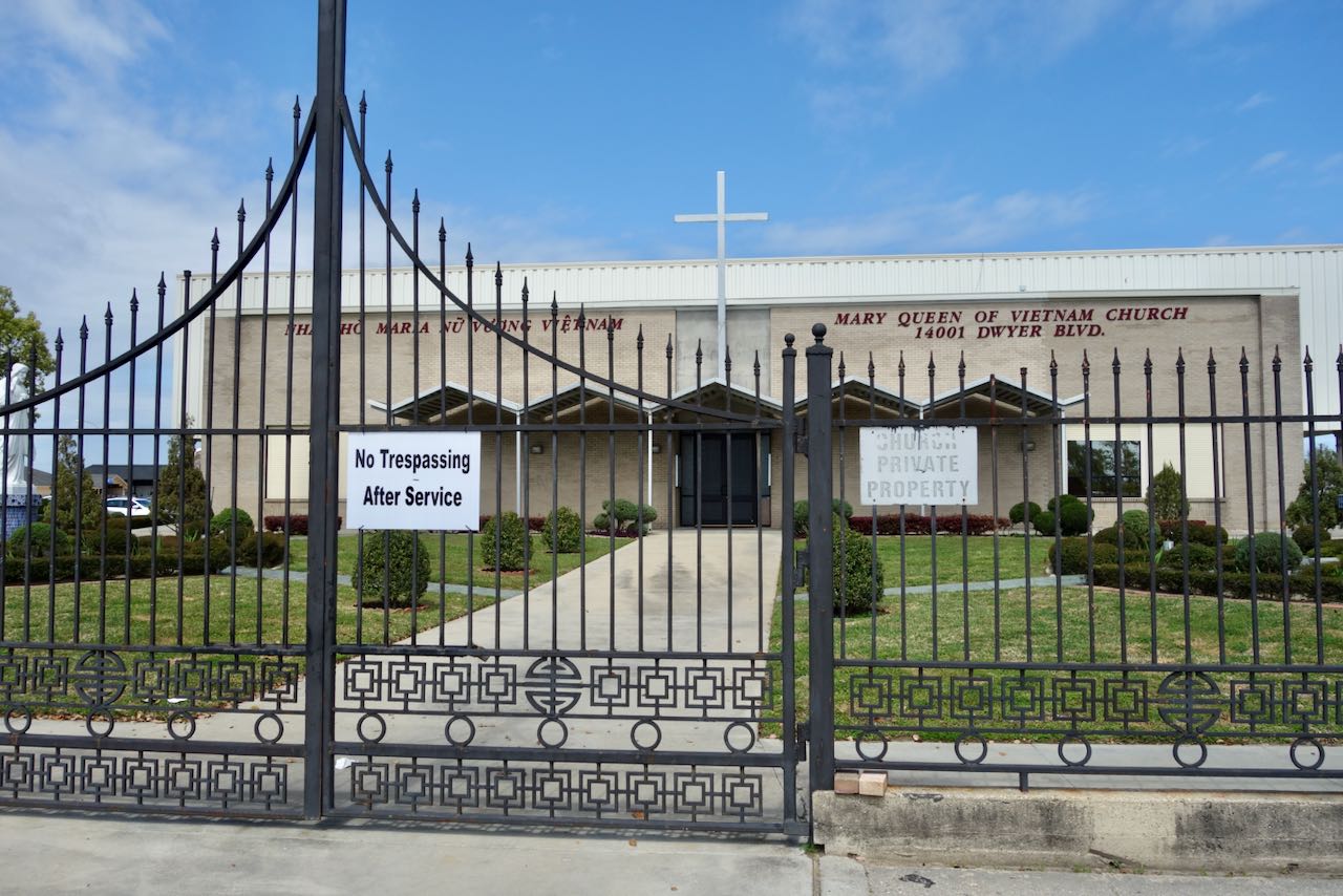
The Vietnamese language Catholic Church had less than welcoming fencing. No Trespassing After Service.
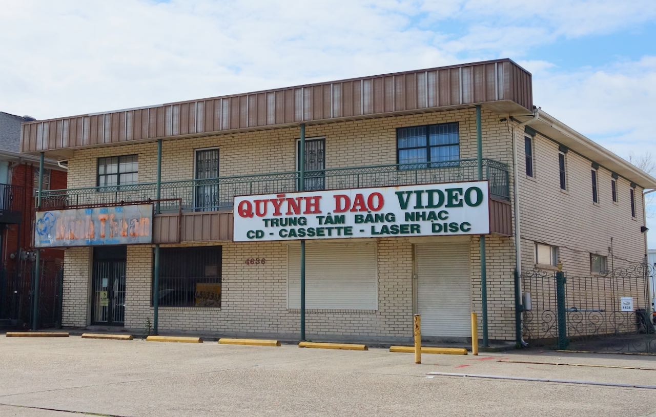
A block or two away was Dong Phuong bakery who makes, it is said, the best King Cakes at Mardi Gras time. Around it is a two block area of Vietnamese storefronts. Some look busy, some look closed or abandoned.
I doubt this video store is in business.
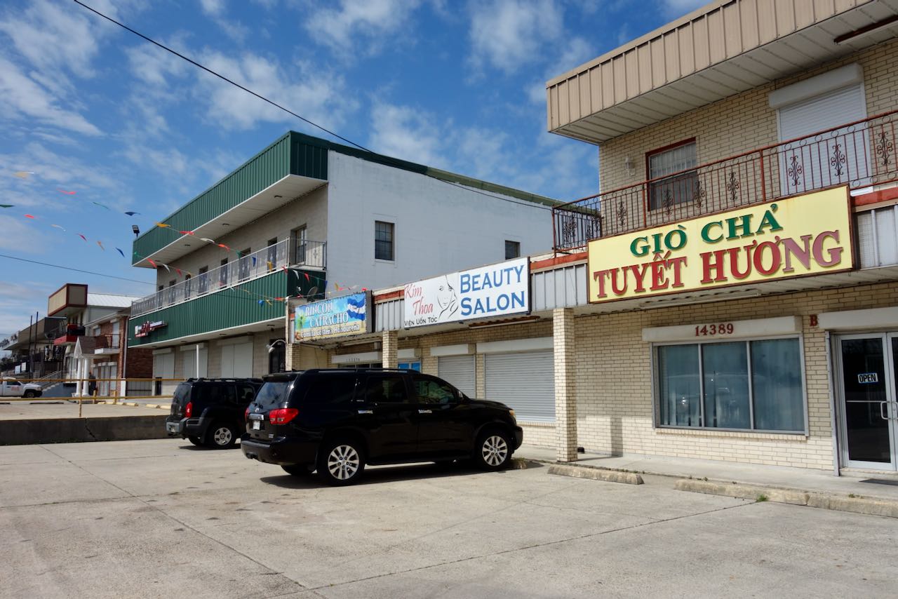
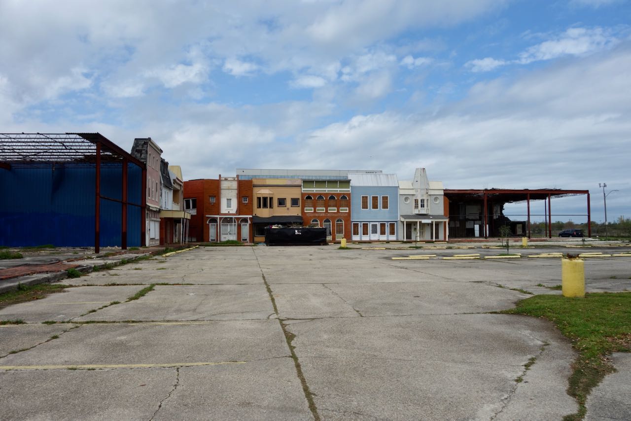
This whole commercial strip felt disjointed, semi-vacant stores in the middle of nowhere. . A formerly Vietnamese grocery had been redone into a Honduran one. There was a Central American taco truck parked on the street. I might have purchased something but as in all of New Orleans East, there was nowhere to sit down. It seems that the Vietnamese retail scene has mostly moved fifteen miles away to another Vietnamese neighborhood on the Westbank, the other side of the Mississippi.
It still needed to eat my lunch, my peanut butter and jelly sandwich. I could not find any kind of park or picnic table but finally ate at a paved strip a few blocks away in the neutral ground in front of Sarah Reed High School, leaning on my bicycle.
It was time to turn and head back in the direction I came, cycling on Lake Forest Boulevard. Soon after passing under I-510 I passed the gated community of big suburban houses known as Eastover. I later researched this online. In a 1994 Times Picayune article the country club neighborhood was described as 45% white, 45% Black and 10% Asian, and residents were quoted as being proud of this mix. It was flooded during Katrina in 2005 and the golf course never reopened. I am fairly certain it is now almost entirely Black. Big impressive houses currently sell for about $ 450,000; much less than the value for such a house in other parts of the city.

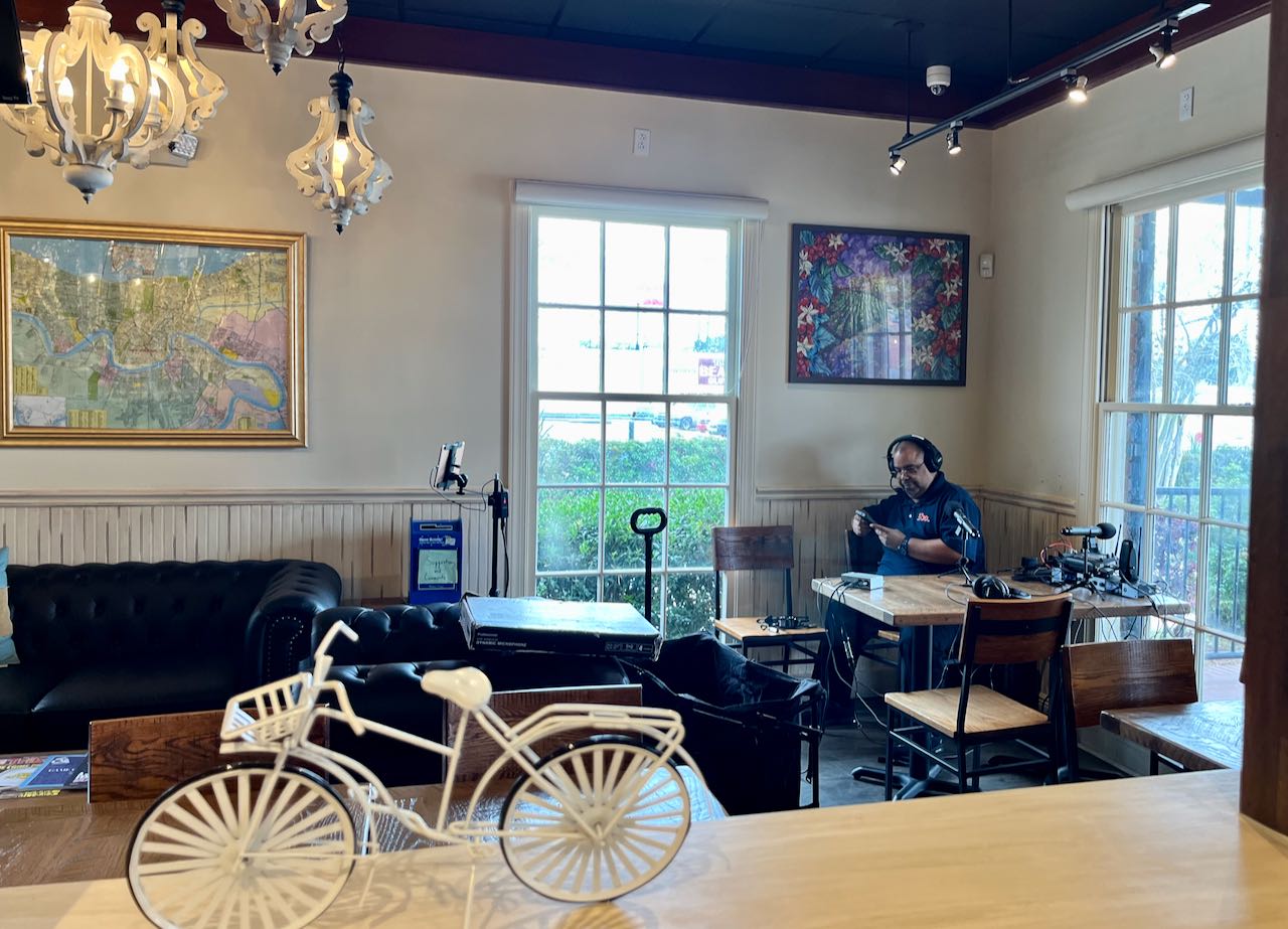
I had been cycling quite a while and I needed a break! . There are few places with inside seating in New Orleans East. One is the local coffee chain PJ’s, on Read Boulevard.

A Black radio station was doing a live broadcast from inside, but there were few people around. I sat outside on the terrace and enjoyed my coffee; oat milk latte with one pack sugar, reading Apple News on my phone.
I pedaled back towards central New Orleans, trying to take a different route as much as possible. It continued to astound me how many vacant commercial buildings are out here.
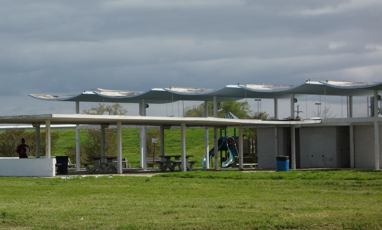
I noodled through the middle class streets of New Orleans East until I arrived at Downman Road, which lead me once again to Leon C. Simon Boulevard, and the bridge across the Industrial Canal. The other side, on the lakefront, was this fetching mid-century modern picnic shelter.
I pedaled most of the way home on Gentilly Boulevard but junted onto St. Bernard Avenue. The prestigious Black and Catholic and all-male St. Augustine High School was having spring football practice.

While it seems like a long way, it really only took about twenty-five more minutes to bicycle from here in the Seventh Ward to my home, our condo in the LGD.

Leave a reply to Suzanne Ehrenhalt Cancel reply